Quantcast
 
 
Download the Merrimack Valley Walking Tour App! Click here to learn more.

Berkshires boasts state and local parks with fun activities all year

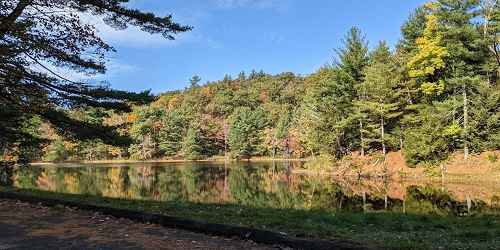
Sandisfield State Forest (York Lake) - Sandisfield, MA - Photo Credit MA State Parks
Sandisfield State Forest (York Lake)

York Lake Road Sandisfield, MA, 01255 Phone: 413-229-8212

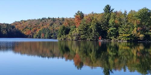
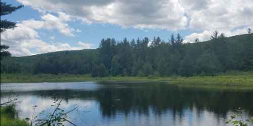
Within the forests of Sandisfield State Forest is York Lake. The lake has a day use area with a 300-foot beach for swimming (no life guards) and picnicking. There is a boat ramp for kayaks, canoes, and small sail boats. York Lake is stocked with trout three times a year. Other activities including walking and hiking, horseback riding and cross-country skiing. The moderately difficult 2-mile Pond Loop Trail offers scenic views of the lake. Hunters are welcome in season.
Season and Hours: Open year round, sunrise to sunset. Facilities are available from Memorial Day through Labor Day.
C.M. Gardner State Park - Huntington, MA - Photo Credit MA State Parks
C.M. Gardner State Park

Route 112 Huntington, MA, 01050 Phone: 413-354-6347

Good for paddling, hiking & walking; fishing; pets allowed except on beach area

C. M. Gardner State Park is located in the rolling Berkshire foothills along a scenic section of the Westfield River East Branch. In summer the sunlit mountain river here is a delightful spot to relax. A wooded picnic area is available on the banks of the river. Swimming is prohibited. A $2 fee per vehicle is charged from Memorial Day weekend through Labor Day.
Hampton Ponds State Park - Westfield, MA - Photo Credit MA State Parks
Hampton Ponds State Park

1048 North Road Westfield, MA, 01085 Phone: 413-532-3985

Located in the City of Westfield, Hampton Pond State Park offers water sports, including beaches, swimming, paddling, motor boating, and fishing. The park has a boat ramp. There is plenty of room for picnicking, and restrooms are provided.
Clarksburg State Park - Clarksburg, MA - Photo Credit MA State Parks
Clarksburg State Park

1199 Middle Road Clarksburg, MA, 01247 Phone: 413-664-8345

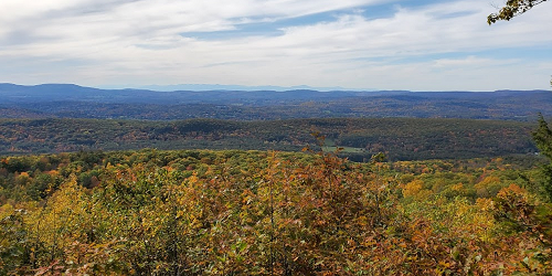
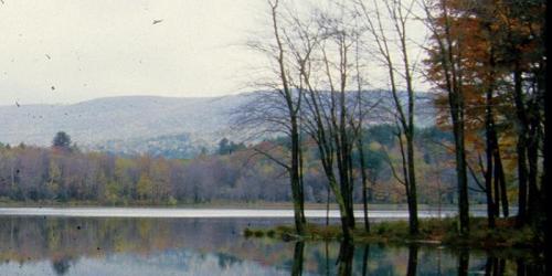
Clarksburg State Park offers 368 acres of unspoiled hardwood forest with views of the Hoosac Range, Mount Greylock, and the Green Mountains. Mauserts Pond has a day-use area with picnicking and a pavilion. The pond is surrounded by 9.5 miles of foot trails. Good for camping, hiking, and boating. Boat Launch is available for non-motorized boats. Prohibited: Motorized off-road vehicles. - Trail Map (PDF)
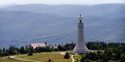
Monument at Mount Greylock State Reservation - Lanesborough, MA - Photo Credit MOTT
Mount Greylock State Reservation

30 Rockwell Road Lanesborough, MA, 01237 Phone: 413-499-4262

This park, at the summit of Mount Greylock, the highest point in Massachusetts, offers magnificent views, hiking, cross-country ski trails, and a semi-primitive campground. Visit the historic Veterans War Memorial Tower at the summit. Primitive camping is available at the Mount Greylock Campground. Bascom Lodge offers lodging and meals from May to October. The Visitor Center is open year-round.
The roads to the summit are open from late May through November 1; in fall, call ahead for current road conditions. Bascom Lodge and the Veterans War Memorial Tower are open seasonally. The Mount Greylock Campground (primitive overnight area) is accessible by hiking only.
Fees: Access to the park is free. Parking fee for the summit parking lot is $5-$6, charged from Memorial Day through Columbus Day. - Trail Map (PDF)
River Bridge - Robinson State Park - Feeding Hills, MA
Robinson State Park

428 North Street Feeding Hills, MA, 01030 Phone: 413-786-2877

Robinson State Park is a popular recreational area in the Springfield region. River Road will take you into an area for swimming, sports, picnic sites, and launching canoes and kayaks. Come and explore 800 acres of scenic forests and shoreline on the Westfield River, and 20 miles of trails for walking, cycling, and horseback riding. - Trail Map (PDF)
Connecticut River Greenway State Park - Northampton, MA - Photo Credit Carrie Beauvais
Connecticut River Greenway State Park

136 Damon Road Northampton, MA, 01060 Phone: 413-586-8706

The Connecticut River Greenway connects open spaces, parks, scenic vistas, and archaeological and historic sites along the length of the Connecticut River as it passes through the state. There are over 12 miles of permanently protected shoreline, and numerous access points to the river. Several larger properties such as Mount Sugarloaf State Reservation, Norwottuck Rail Trail, and the Great Falls Discovery Center (located in Turner's Falls) provide added visitor amenities.
Lake View - Brimfield State Forest - Brimfield, MA - Photo Credit Michael Laferriere
Brimfield State Forest

86 Dearth Hill Road Brimfield, MA, 01010 Phone: 413-267-9687

This sprawling green area boasts over 20 miles of roads and trails. Dean Pond Recreation Area, located in the western portion of Brimfield State Forest, has a pavilion, comfort station, a small beach and picnic area. The roads are popular for equestrian use and related special events. Accessible Restrooms. Recreational uses: fishing, group day use, horseback riding trails, hunting (with restrictions), mountain biking, picnicking, cross-country skiing, swimming, walking trails. Headquarters and Dean Pond Recreation Area are located off of Route 20 in south-central Massachusetts. - Trail Map (PDF)
Trail - Chester-Blandford State Forest - Blandford, MA - Photo Credit MA State Parks
Chester-Blandford State Forest

20 Chester Road Chester, MA, 01008 Phone: 413-354-6347

Chester-Blandford State Forest offers a rustic park experience and spectacular Sanderson Brook Falls. Boulder Park features an easy interpretive trail and pavilion. Hike up an easy grade for a mile to see the cascade at Sanderson Brook Falls; hike the Newman Marsh Memorial Trail to the top of Observation Hill. Access is free. Limited number RV sites. Carry-in, carry-out all trash. Be aware of bears. Pets permitted on a leash. Motorized off-road vehicles prohibited. Swimming prohibited at Sanderson Brook Falls. - Trail Map (PDF)
Season & Hours: Open year-round, sunrise to sunset. Swimming prohibited at Sanderson Brook Falls.
Foliage View - Beartown State Forest - Monterey, MA - Photo Credit John Melanson
Beartown State Forest

69 Blue Hill Road Monterey, MA, 01245 Phone: 413-528-0904

Beartown State Forest is open year-round. During the warm months Benedict Pond attracts swimmers, boaters, and fishermen. A network of trails offers visitors a chance to see animals, forests, and fall foliage. Open in winter for cross-country skiing, snowshoeing, and snowmobiling.
Unguarded swimming is available at designated areas only. Non-motorized boating at Benedict Pond day-use area. All Terrain Vehicles are permitted from May 1 through November. Snowmobiling is available, with parking at Benedict Pond day-use area. - Trail Map (PDF)
Lake View - Savoy Mountain State Forest - Florida, MA - Photo Credit Bailey Fogle
Savoy Mountain State Forest

260 Central Shaft Road Florida, MA, 01247 Phone: 413-663-8469

There are virtually endless recreational opportunities at Savoy Mountain State Forest. Fifty miles of wooded trails lead to floating bogs and the cascading, 50-foot Tannery Falls, where Ross Brook flows through a deep chasm. Serene North and South Ponds are surrounded by forest and walking trails; North Pond has a boat ramp, and both ponds have beach areas. Unguarded swimming is available at the North Pond day-use area. Both ponds make excellent picnic sites.
There are 45 campsites in an apple orchard. Pets are permitted except on the beach area and in the cabins; maximum 10-foot leash. - Trail Map (PDF)
Amenities: Restrooms, showers, handicap-accessible sites. Motorized off-road vehicles, alcoholic beverages, swimming and rock climbing at Tannery Falls area are prohibited.
Season & Hours: The park is open year-round, 8 a.m. to dusk.
Paddling at October Mountain State Forest - Lee, MA - Photo Credit MA State Parks
October Mountain State Forest

317 Woodland Road Lee, MA, 01238 Phone: 413-243-1778

Visitors to October Mountain can camp, hike, and enjoy the outdoors and have near access to Tanglewood. Forty-seven campsites dot a sunny hillside. Trails are available for every level of fitness. A scenic trail leads through Schermerhorn Gorge, a striking natural feature.
Camping season is from mid-May through mid-October. Maximum RV size is 34 feet. No electric hook-ups. ATVs are permitted on designated trails. Car-top boat ramps are available at Housatonic River (access at New Lenox Road), Buckley Dunton Reservoir, and October Mountain Reservoir day-use area. Snowmobiling is available on four-inch snow base. This is black bear country - Never confront or feed bears! - Trail Map (PDF)
Season and Hours: Open from sunrise to one half-hour after sunset. Access is free.
Chicopee Memorial State Park - Chicopee, MA - Photo Credit MA State Parks
Chicopee Memorial State Park

570 Burnett Road Chicopee, MA, 01020 Phone: 413-594-9416

Chicopee State Park, previously called the Cooley Brook Reservoir, has a 25-acre pond for swimming and fishing. Beach is wheelchair accessible. Picnic grounds and restrooms also are available. The park has trails for walking and bicycling. The park is open daily, 8 a.m-4 pm. During busy weekends and some holidays, the parking lot may be filled and therefore temporarily closed until more parking is available. For information on parking lot closures and openings, consult Twitter at@MassDCR. - Trail Map (PDF)
Natural Bridge State Park - North Adams, MA - Photo Credit Leh-Wen Yau
Natural Bridge State Park

McCauley Road, off Route 8 North Adams, MA, 01247 Phone: 413-663-6392

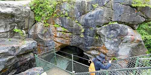
This 48-acre park has the only naturally formed white marble arch and man-made white marble dam in North America. The bridge spans Hudson Brook as it twists and tumbles through a steep 60-foot deep gorge. There is an abandoned marble quarry. In the summer months, park interpreters are on hand to explain the natural forces that created the bridge and its more recent history. Explore the area on a quarter-mile walkway above and through the chasm, and a half-mile wooded walking trail.
Open Memorial Day through Columbus Day, 9 a.m. to 5 p.m. Parking fee is $2. Tables and grills are available for picnicking. Please carry-in, carry-out all trash. Access is limited. Leashed pets permitted. Swimming, rock climbing, defacing rocks, and alcoholic beverages are prohibited.
Bash Bish Falls State Park - Mount Washington, MA - Photo Credit MA State Parks
Bash Bish Falls State Park

Falls Road Mount Washington, MA, 01258 Phone: 413-528-0330

Bash Bish Falls has the highest single-drop waterfall in the state. Water tumbles through gorges and a hemlock-hardwood forest. Bash Bish Falls is located next to Mount Washington State Forest, with 30 miles of trails, including the South Taconic Trail and wilderness camping. Parking is allowed only at the designated lot. No services are available; anything you carry in, you must carry out of the park. Bring your own grill. Swimming, diving, entry inside the gorge, and rock climbing are prohibited. Open sunrise to sunset. - Trail Map (PDF)
Hiking View - Mount Washington State Forest - Mt. Washington, MA - Photo Credit MA State Parks
Mount Washington State Forest

545 East Street Mount Washington, MA, 01258 Phone: 413-528-0330

This red oak northern hardwood forest offers rugged terrain for hikers and rustic camping. Follow the South Taconic or Appalachian Trail along a great ridge and through Sage’s Ravine. Come in spring to bask in the blooming mountain laurel and azalea, and visit in summer to see the terrain blanketed in ferns. Be aware of bears. Prohibited: motorized off-road vehicles, snowmobiles and alcoholic beverages. - Trail Map (PDF)
Forest in Mohawk Trail State Forest - Charlemont, MA
Mohawk Trail State Forest

175 Mohawk Trail (MA Route 2) Charlemont, MA, 01339 Phone: 413-339-5504

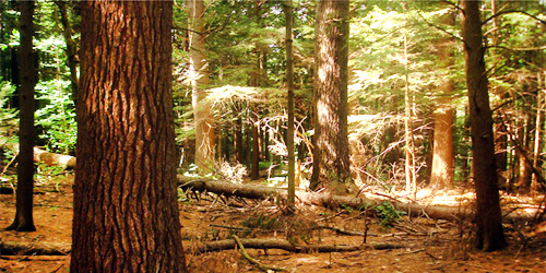
This 6,000-acre state forest is steeped in scenic history. Discover naturally formed gorges and ancient trees; most likely, you’ll spot some wildlife on your way. Follow the Mohawk Trail on foot or on a recreational vehicle (season permitting), and follow the sound of the stream to the riverside. Camp in a rustic setting at various sites in any season, or just stay the day and enjoy a picnic by the streambed, watching the fishermen hunt for trout. Swimming permitted in the designated area. - Trail Map (PDF)
Season & Hours: Park is open year-round, Sunrise to Sunset. Campsites open from May thru mid-October.
Wendell State Park - Wendell, MA - Photo Credit MA State Parks
Wendell State Forest

392 Montague Road Wendell, MA, 01379 Phone: 413-659-3797

This 7,566-acre park has plenty of recreational opportunities including two ponds, a cranberry bog, brooks and streams, a ballfield, and the Metacomet-Monadnock hiking Trail. Ruggles Pond, the day-use area, has a restroom, picnic sites, and a swimming beach. - Trail Map (PDF)
Pittsfield State Forest - Pittsfield, MA - Photo Credit Mark Flapps
Pittsfield State Forest

1041 Cascade Street Pittsfield, MA, 01201 Phone: 413-442-8992

Good for handicap-accessible recreation, fishing, walking & hiking.

Handicap visitors can enjoy nature freely here, at accessible hiking trails, picnic sites, restrooms, and scenic vistas. Everyone will like the variety of recreational activities this state forest offers, including camping, picnicking, swimming at the beach, and fishing. After a day of hiking and exploring Berry Mountain, take in gorgeous hilltop views of the sunset. Fishing in Berry Pond. Check out the nearby Balance Rock State Park, located in the northeast corner of the forest, to see a unique natural spectacle: a large boulder balanced naturally on another rock. - Trail Map (PDF)
Season & Hours: Sunrise - 8 p.m., year-round. $2 parking fee, early May - early September.
Sunset View - DAR State Forest - Goshen, MA - Photo Credit A. Blechner
D.A.R. State Forest

78 Cape Street - MA Route 112 Goshen, MA, 01032 Phone: 413-268-7098

This public forest includes Upper and Lower Highland Lakes, with a swimming beach, picnic area, and group picnic pavilion. There are 15 miles of mixed-use trails through the forest. The campground offers 51 wooded campsites with showers and a private beach. Everyone can enjoy nature in this forest: wheelchair accessible campsites are available. Activities include paddling, hiking, fishing, horseback riding, mountain biking, ice skating, cross-country skiing, snowshoeing, and snowmobiling. Pets are permitted except on the sandy beach area. Non-motorized boating is available. - Trail Map (PDF)
Season & Hours: Open year-round, sunrise until sunset.
Reservoir - Tolland State Forest - East Otis, MA - Photo Credit Anne Iverson
Tolland State Forest

410 Tolland Road East Otis, MA, 01029 Phone: 413-269-6002
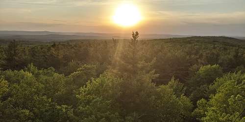
Come and explore the 1,065-acre Otis Reservoir, which is the main attraction of this state forest. The lake has an activity for everyone's taste, from extreme recreation to a relaxing swim or boat ride. Camp on a beautiful wooded peninsula and watch the sun set and rise over the southern Berkshire Hills. Pick your favorite outdoor recreational activities, or try something new. Go hiking, fishing, swimming, paddling, or have a picnic. Be aware of hunters, off-road vehicles, and mountain bikers. - Trail Map (PDF)