Quantcast
 
 
Adventures in Recreation and Exploration Await in the Greater Merrimack Valley of Massachusetts! Click here to Learn More.

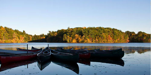
Greater Boston and Cambridge host padding, canoeing, kayaking adventures

Mary O'Malley Park

Commandants Way Chelsea, MA Phone: 617-727-5380

Part of the Mystic River Reservation, a string of parks along the Mystic River, Mary O’Malley Park has a boat landing, granite pier, and a shelter. Nice views of the Tobin Bridge over the Mystic River. Park also has tennis courts and an open lawn. Hours: Open year-round, dawn to dusk.
Peters Reservation

Farm Road Dover, MA, 02492 Phone: 508-785-0339
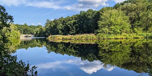
From the entrance on Farm Street, boaters can portage to the put-in, or canoes and kayaks on the Charles River can land along the plantation of red pines that lines much of the reservation's frontage on the river. Over two miles of trails traverse woodlands featuring a large, massed planting of Dexter hybrid rhododendrons and an oak and hickory forest, whose trails and understory plantings were laid out by landscape architect Fletcher Steele.
Cochituate State Park - Natick, MA
Cochituate State Park

43 Commonwealth Road Natick, MA, 01760 Phone: 508-653-9641

This lake is composed of three large, north-to-south segments. A boat ramp is located on Middle Lake. Boating regulations: Alcohol is prohibited; lifejackets must be worn by canoeists and kayakers from September 15 to May 15; water skiing is allowed on South Lake only; power loading of vessels at ramp is prohibited; boating allowed only during daylight hours; swimming from boats is prohibited; boaters are responsible for their wake; no personal watercraft or ATVs are allowed on or around the lake.
Hours (Summer): 8am - 8pm, bathrooms locked at 7pm.
Parking Fees (May-October): $8 for MA Residents; $30 for Out-of-State Resident
Rocky Narrows - Sherborn, MA - Photo Credit Ian Hersmdolf-Placido
Rocky Narrows

South Main Street Sherborn, MA, 01770 Phone: 508-785-0339

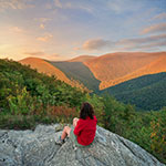
Known as the "Gates of the Charles," Rocky Narrows’ canoe landing connects to a two-mile loop trail that follows the river's edge to the Rocky Narrows Overlook. The overlook rewards visitors with views of steep, hemlock-clad rock cliffs that form a narrow river passage - the landmark that gives the reservation its name. Further south along the trail is King Philip's Overlook, named for the Wampanoag chief who warred against the early settlers of the Massachusetts Bay Colony.
Charles River Peninsula - Needham, MA - Photo Credit Brian Robinson
Charles River Peninsula

Fisher Street Needham, MA, 02492 Phone: 781-821-2977
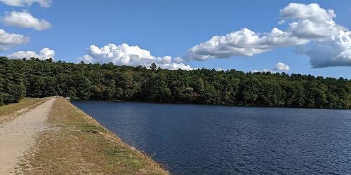
Scenic paddling along the Charles River will take you to this reservation, where the Charles River makes a nearly 180-degree twist in the valley, a wooded shoreline of birch, hemlock, and beech conceals an upland peninsula that rises gently to a 20-acre open field, which has been farmed for more than a century. A narrow footpath tracks the river along the Reservation's shoreline, while the field's highest point offers views of the Charles River.
Reservoir - Ashland State Park - Ashland, MA
Ashland State Park

162 West Union Street Ashland, MA, 01721 Phone: 508 881-4092
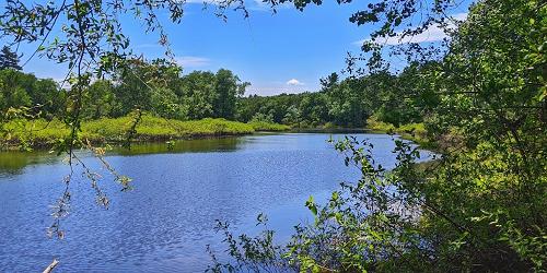
Ashland State Park is located on the large Ashland Reservoir. Paddling in canoes and kayaks is allowed. The park has a boat ramp. There is wheelchair access to the beach, bathhouse, picnic and hiking trails.
Parking: Available mid-May to Labor Day, $8 daily for MA vehicles and $30 daily for out-of-state vehicles. - Trail Map (PDF).
Mystic Lakes

Between Route 3 and Mystic Valley Parkway Winchester, MA, 01890 Phone: 617-727-5380

On these twin lakes just a stone’s throw from Boston, sailing programs are offered at the Tufts University Boathouse. Upper Mystic Lake is limited to paddling (canoes, kayaks), only. Power boat owners may use the Lower Mystic Lake. No wakes.
Bridge Island Meadows

South End Pond Millis, MA, 02054 Phone: 781-821-2977

Accessible only by boat, Bridge Island Meadows is surrounded by wetlands and thus a private favorite of intrepid paddlers. Kayakers can paddle on the Charles River, turning west into a stream that leads to South End Pond. Bolder paddlers can creep along Bogastow Brook to South End Pond. Landing is a challenge, as grasses grow tall and thick. A successful journey is rewarded by bushwhacking to a 130-foot tree-covered knoll at the south end of the reservation offering glimpses of the surrounding floodplain.